Propeller Aero partners with Wingtra on data and 3D mapping
Propeller Aero, the drone data visualization and analytics platform and Wingtra, the professional Vertical Take Off and Landing (VTOL) drone manufacturer for mapping and surveying, have joined forces to deliver highly accurate site data and 3D mapping to construction and earthworks companies globally.
Designed specifically for the construction and earthworks industry, the Propeller Platform and WingtraOne drone partnership make it easy for construction professionals to collect survey-grade data across their entire worksite, consistently and accurately. What used to take days or weeks, can now be completed in hours, with more accuracy and reliability.
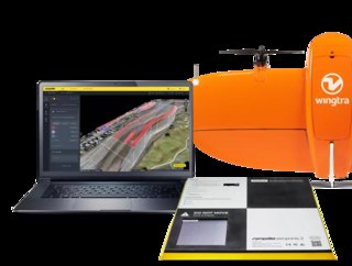
To operate, Surveyors place Propeller AeroPoints (smart ground control points) on their worksite, then fly the WingtraOne drone to collect worksite survey data. Survey images are uploaded to Propeller’s cloud-based platform where the fully automated geotagging and photogrammetry processing is completed within 24 hours of submission on the platform.
“Many Propeller customers are flying massive mines, road and railway projects, and other large sites, and are seeing the value of VTOL drones for their operations,” said Jack Nachazel, Customer Success Engineer at Propeller Aero. “Our partnership with Wingtra meets a significant demand in the industry for more efficient and highly accurate survey data that supports not only time and cost savings, but also reliable data you can trust."
WingtraOne data collection with AeroPoints and Propeller PPK reduces risk and improves efficiency by serving as a reliable, single source for survey data and progress. Unlike traditional survey methods, which require manual, error-prone data collection, surveyors can quickly and easily fly their site on a regular basis to collect and process survey data.
Teams across the entire worksite can view geographically accurate and realistic 3D site models and track, inspect, and report on job progress and productivity safely and accurately. This increased accuracy and reliability has been shown to reduce conflict, more quickly resolve disputes, and drive more pre-construction bid precision.
“Improving accuracy, reliability, and efficiency for survey data is imperative for our customers. Partnering with Propeller to provide a complete solution with the WingtraOne drone, AeroPoints™, and Propeller’s PPK data processing and visualization is the right step toward better serving our customers,” said Julian Surber, Product Manager at Wingtra.
Whether it’s a highway, an industrial complex, or a mine, Propeller and Wingtra enable surveyors to seamlessly collect and analyze survey-grade data to ensure their projects are on track, on budget, and on spec.
HCSS, a leading provider of innovative solutions that help heavy civil businesses streamline their operations, recently introduced a new version of HCSS Aerial, a drone-based data analytics platform. This upgrade, the sixth major release of the software since the product was launched in March 2020, contains design visualization and digital inspection enhancements.
Demand for autonomous last mile delivery is skyrocketing with the rising adoption of autonomous vehicles for the delivery of products without any human intervention. The market is registering stellar projections with increasing demand for aerial delivery drones.
- China State Construction: The Globe’s Largest ContractorProject Management
- Top 10 sustainable construction startupsConstruction Projects
- East Penn powers an industrial closed loop circular-economyTechnology & AI
- The state of waste management in the construction industryConstruction Projects